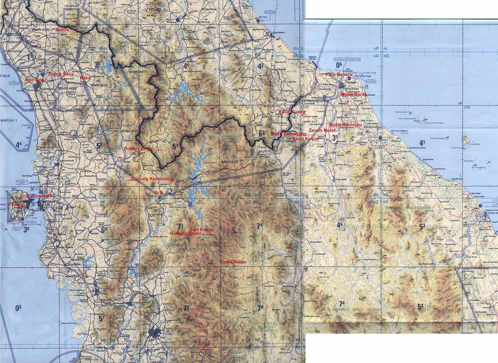
Map of Northern Malaya
Annotated in red with
names mentioned in 84 Field Survey Squadron Memories.
Some places I have been unable to
locate, these include Crow & Kuala Langat, maybe some kind soul with
rectify these omissions.
I think the village referred to might be Croh, or Kroh. It had a large tin mine in the vicinity. I was there for a brief period in 1957 and it had the dubious distinction of being one of the last places where the CT's had recently attacked in force, before hopping back over the border again . I remember plenty of wire meshed fencing between the safe compound and the jungle and we were a bit jittery at the time.
Bukits Kusial, Kuang, Meninjau and Marak were used later by 1 Topo Troop in 1967/8. I wonder if surveyors from the fifties also used them.
The original map scale was 1:500,000
Map produced from TPC L-10B dated
1989 and TPC L-10A dated 1991
© Crown copyright 1989 & 1991. Reproduced with the permission of the
controller of her Majesty's Stationery Office.